This SPEAR research strand studies feature-level radar–LiDAR fusion for binary occupancy-grid mapping in automotive driving. Radar is robust in rain, fog and darkness but its detections are sparse and noisy; LiDAR gives accurate range but degrades in adverse weather and produces ground scatter. The question is how to combine them so the map is more accurate than either sensor alone.
The problem
Occupancy-grid mapping estimates which cells are occupied from point-cloud measurements. Obstacles only show up at their edges, so the map is mostly empty and strongly spatially sparse. Mapping with a single modality either misses detections (radar) or degrades with weather and ground returns (LiDAR), and high-level fusion cannot exploit complementary measurements at the grid level.
Fusion as sparse reconstruction
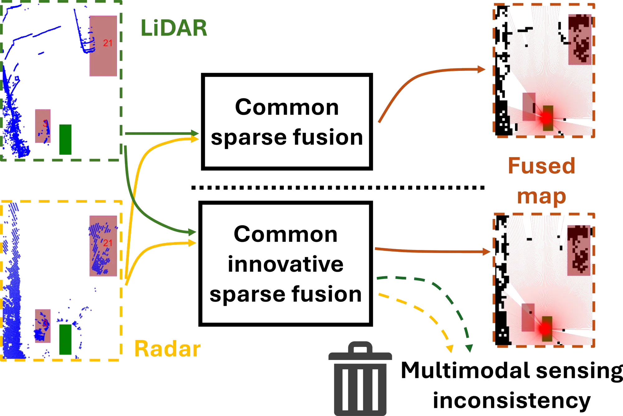
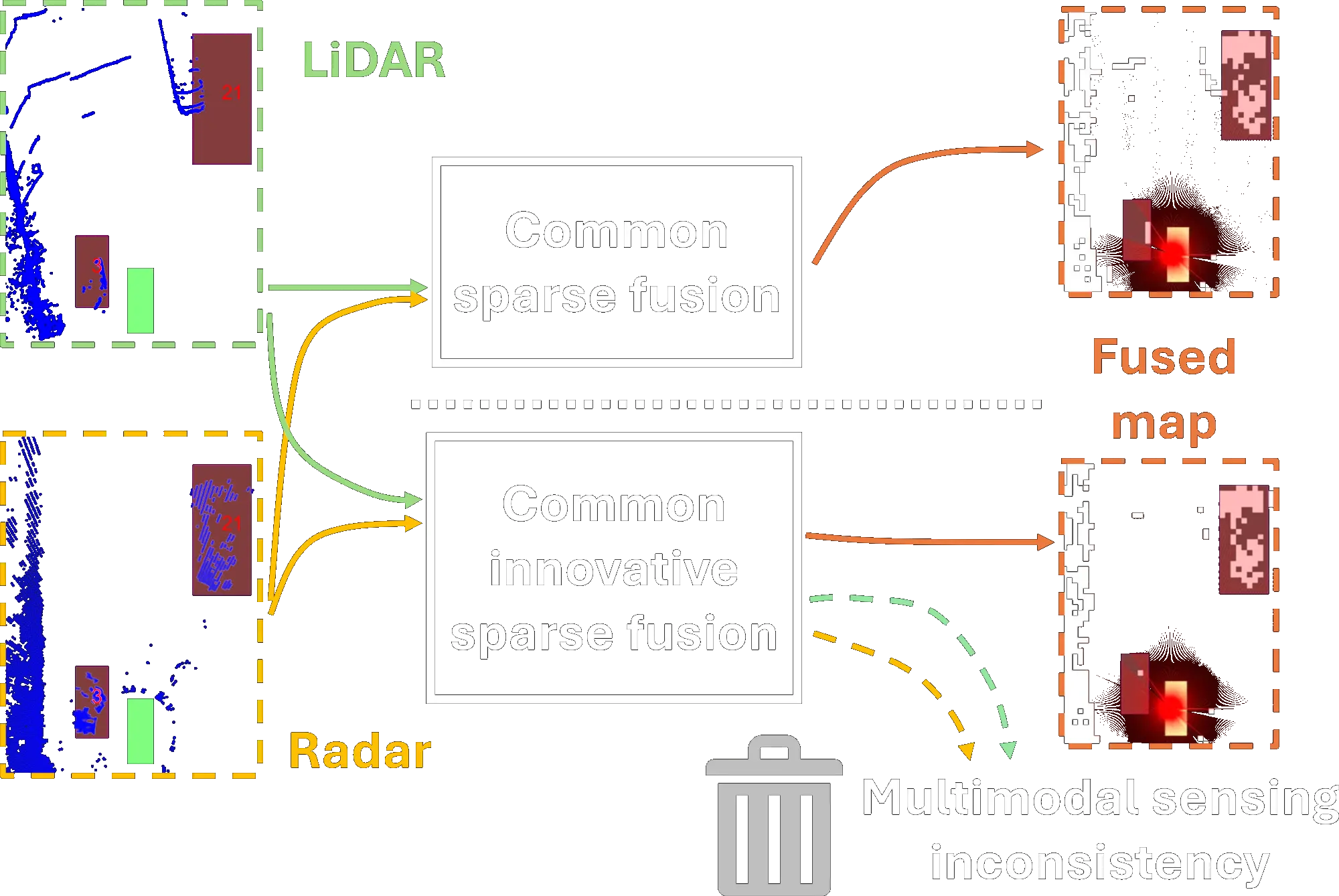
Both the conference and journal papers model occupancy mapping as sparse binary-vector reconstruction with pattern-coupled sparse Bayesian learning (PCSBL), and introduce two feature-level measurement models for fusion:
- Common sparse fusion (CS). A single common map is estimated jointly from all radar and LiDAR measurements.
- Common innovative sparse fusion (CIS). A shared map is learned together with an innovation (error-collector) component for each modality. The error collectors absorb sensor-specific false alarms or model mismatch, so the estimate is robust to sensor mismatch, calibration errors, and inconsistencies between the two modalities.
Results
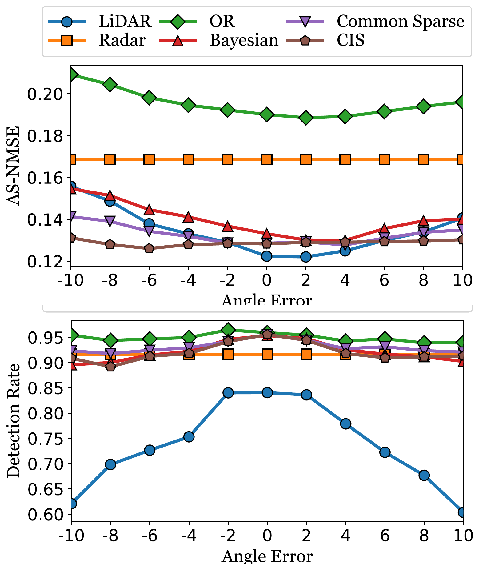
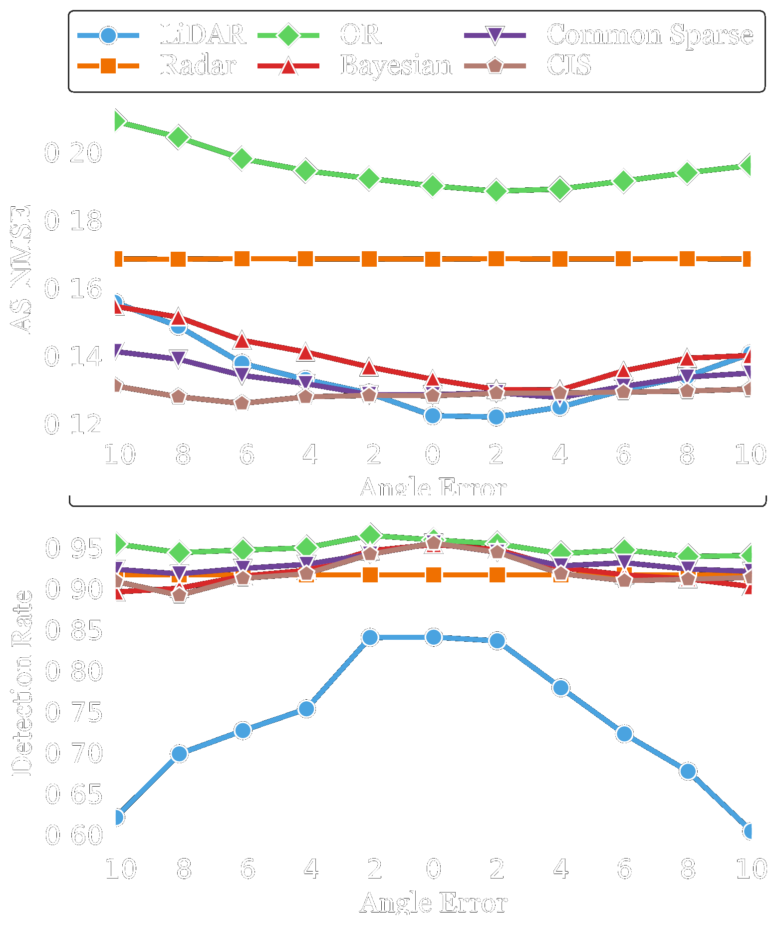
Experiments on the public RADIATE dataset show that the fused models outperform single-modality and high-level fusion baselines. The CIS model is the most robust to angular misalignment: it keeps a high detection rate and low AS-NMSE as the angle error grows, whereas LiDAR-only detection falls to 0.61 at large angle errors.